Ensure safe drone operation in all weather conditions. This essential mobile app for UAV and DJI pilots provides critical pre-flight information.
Before launching your drone, utilize this indispensable app for safer flights. Access real-time weather data and identify no-fly zones via an integrated air map.
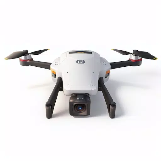
Fly your UAV, RC aircraft, or DJI drone with confidence!
This all-in-one drone app offers:
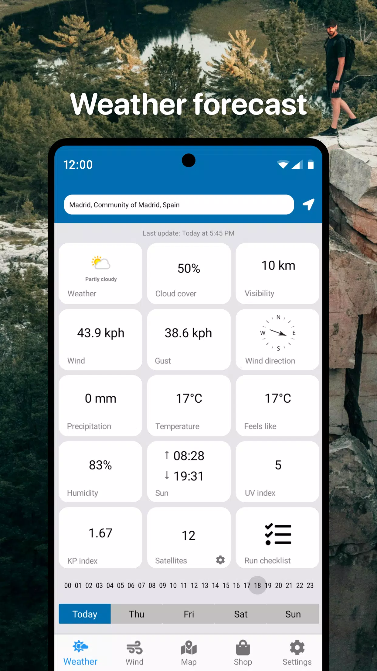
- Detailed, real-time weather forecasts for your chosen location.
- Hourly and 3-day forecasts.
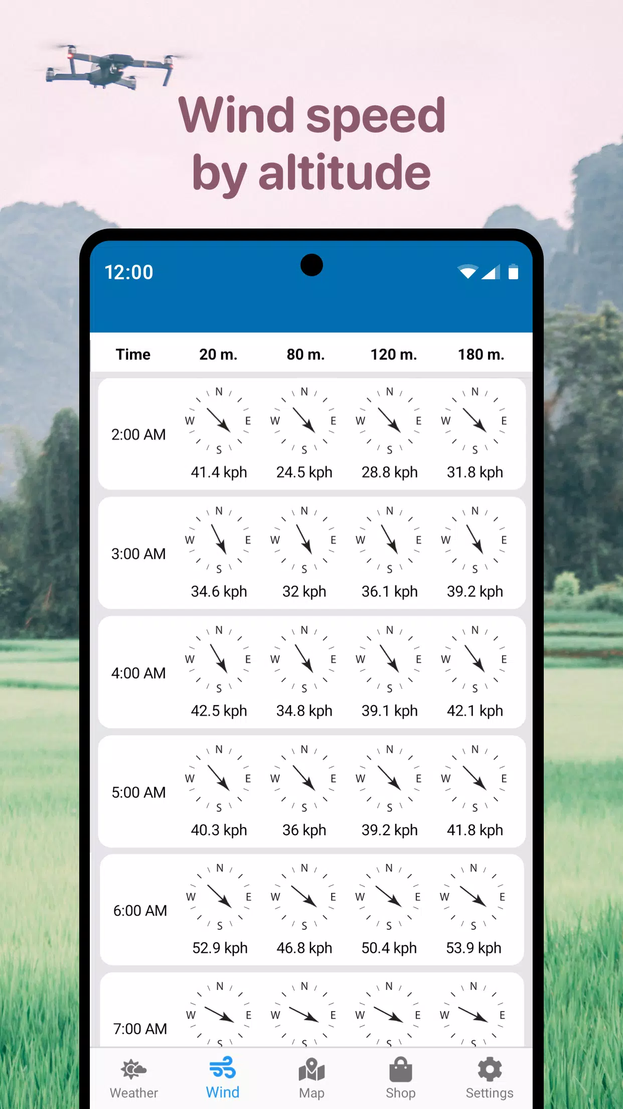
- Wind speed, maximum gusts, direction, and altitude-specific details.
- Sunrise and sunset times.
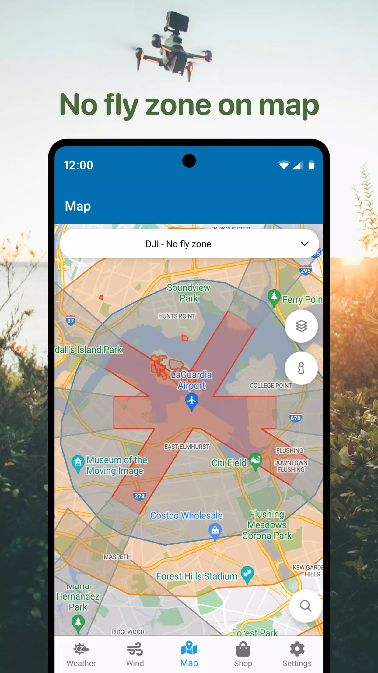
- No-Fly Zone air map.
- Compass for wind direction detection.
- Other helpful parameters for DJI and various other drone models.
Utilize the No-Fly Zone map to identify safe airspace for your quadcopter flights. Avoid airports, heliports, and red-marked restricted areas.
This app is the perfect tool for safe drone deployment, helping you avoid unfavorable weather and restricted zones. Quickly access crucial information for efficient flight planning. Includes wind forecasts and a no-fly zone map.
Compatible with a wide range of drones: DJI Mavic, DJI Phantom, Inspire, DJI Mini, DJI Air, Spark, Parrot Bebop, Xiaomi, Autel, Walkera, Yuneec, Hubsan, FIMI, Syma, Volocopter, Skydio, and other Unmanned Aerial Vehicles (UAVs).
Download the app today and fly your RC aircraft, UAV, and DJI drones safely and confidently.
What's New in Version 1.4.5
Last updated October 22, 2024
- Performance improvements.